Awatere Land Use Optimisation
An additional 270-ha of native reversion forestry was registered for ETS and will generate significant annual cashflow.


Challenge
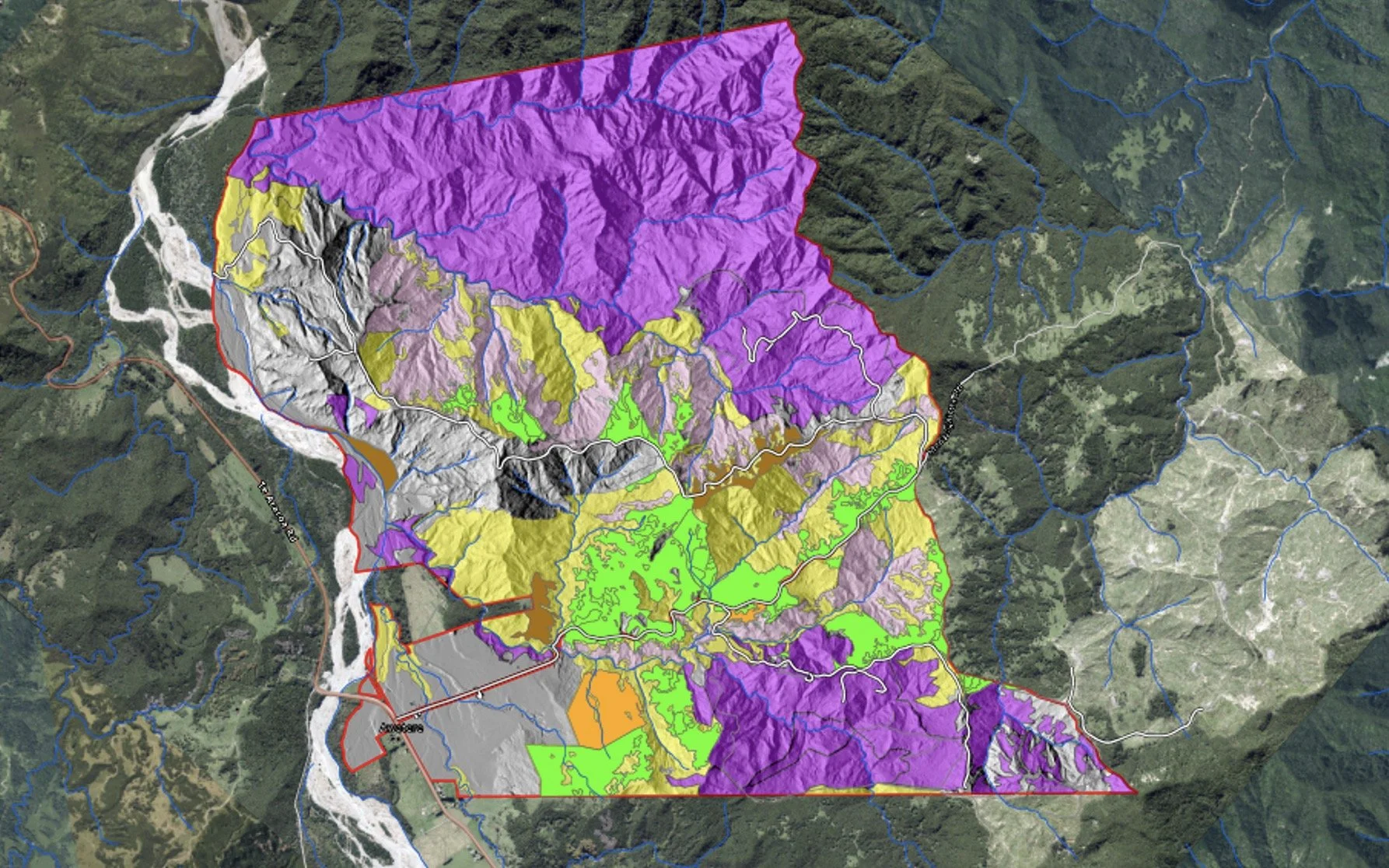
Awatere B Station is a Maori-owned landblock in Te Araroa comprising 1,520-ha of recently harvested forestry, ETS native reversion forest, Pre-1990 native forest, manuka honey and agricultural land units. The Board wished to consolidate their multiple landuses and optimize their outcomes within the framework of their core values and aspirations for their whenua. Rata was engaged to develop a multiple landuse optimization model to inform the board for landuse decisions\, and to provide RMA and ETS risk assessments.

Solution
We used spatial attributes to identify optimal landuse units that aligned with the Boards value set. We completed RMA and ETS assessments and developed strategies for the Board to avoid deforestation liabilities and RMA non-compliance risks. We did a thorough ETS assessment for the station and identified an additional 270-ha of native reversion forest that can be registered for ETS. We developed a business case that showed cashflow projections out to 60-years to help inform the Board with landuse decision making.

Impact
This project informed landowners and empowered them to make informed decisions. The additional 270-ha of native reversion forestry was registered for ETS and will generate significant annual cashflow.